
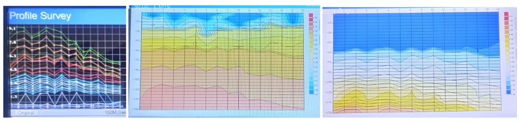
Finding groundwater has always involved uncertainty. What has changed is our ability to investigate what may be happening beneath the ground before the drilling rig arrives.
WELLSPRING uses the PQWT-TC150, a portable geophysical instrument that uses a passive natural-electric-field method commonly described in scientific literature as the Natural Electric Field (NEF) method or Telluric Electric Frequency Selection Method (TEFSM).
Rather than injecting an electrical current into the ground, the instrument measures naturally occurring electrical potential differences at multiple frequencies along a survey line. Changes in those measurements can reveal electrical variation associated with changes in subsurface materials and geological structure. It does not take a picture of groundwater.
The resulting data provide another layer of evidence. WELLSPRING considers those measurements alongside terrain, geology, existing well records, springs and surface water, vegetation, drainage patterns and observations made on the property.
An electrical anomaly by itself is not proof of groundwater. Different geological conditions can produce electrical responses, which is why interpretation, field evidence and repeatable spatial patterns matter.
The equipment collects the data. The methodology acquires the target.
INTERPRETATION TESTED BY DRILLING
Granite Aquifer
Eswatini, 2024
TEFSM was used to investigate candidate borehole sites. Researchers then compared their interpretations with the geology and groundwater encountered during drilling.
WHY IT MATTERS
Drilling provides the test. Electrical anomalies require geological and field interpretation.
THE SAME INSTRUMENT
Aquifer Zone Mapping
Nepal, 2025
Researchers used the PQWT-TC150 specifically to investigate subsurface electrical responses and delineate aquifer zones. Survey results were interpreted alongside local hydrogeological information to identify promising locations for groundwater development.
WHY IT MATTERS
Published research exists using the same instrument employed by WELLSPRING
Dolomite Aquifer
South Africa, 2024
TEFSM identified groundwater targets before drilling. Subsequent drilling corroborated the interpretation and encountered the targeted dolomite aquifer at approximately 170–210 metres.
WHY IT MATTERS
The geophysical interpretation was tested against what the drill actually encountered.
THE METHODOLOGY ACQUIRES THE TARGET.
SEEK & FIND
Reconnaissance and survey lines are used to identify an area showing groundwater potential.
→
TARGET & IDENTIFY
Where potential has been identified, Assessment and Explorer investigations use a three-parallel-line grid to test whether the feature repeats spatially and to identify the best-supported well location and target depth.
→
DRILL & LEARN
The drill tests the target. The drilling result becomes evidence—confirming the interpretation or teaching us something that improves the next investigation.
Uncertainty about the outcome is not uncertainty about the job.
WELLSPRING's job is to investigate the evidence and target the best-supported location for a well.
The technology behind that work is not experimental. Electrical and natural-field geophysical methods are used around the world for groundwater investigation, and geophysical groundwater services are also provided by larger professional firms across Canada. What is less common—particularly in rural communities—is affordable, property-scale access to this kind of investigation before drilling.
WELLSPRING brings that capability directly to rural property owners in the Kootenays: combining portable geophysical technology with terrain, geology, well records, surface-water observations and a repeatable field methodology to seek and find groundwater potential, then target and identify the best-supported location for a well.
The technology is established. The scale of access is changing.